25 Amazing Finds On Google Earth
By
Missy aka Tizzy in
Amazing
On 12th December 2016
Google Earth is a virtual globe, map and geographical information program. It maps the Earth by the superimposition of images obtained from satellite imagery, aerial photography and geographic information system (GIS) 3D globe. Just like their data-rich Maps and Street View offerings, Google Earth is a treasure trove of oddities.
You’ve no doubt already come across some interesting finds on Google Earth. The post below attempts to compile the most fascinating sites other have stumbled upon browsing Google Earth. From natural formations to human structures, the world is a different place when viewed from above.
If you’re interested in seeing any of the places yourself, I’ve included the coordinates for every image shown below. Just copy and paste into Google Earth/Maps and explore for yourself!
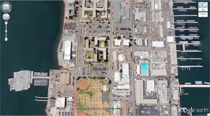
#1
Swastika-Shaped Building Complex
32°40'34.19″N 117° 9'27.58″W
Coronado, California, USA
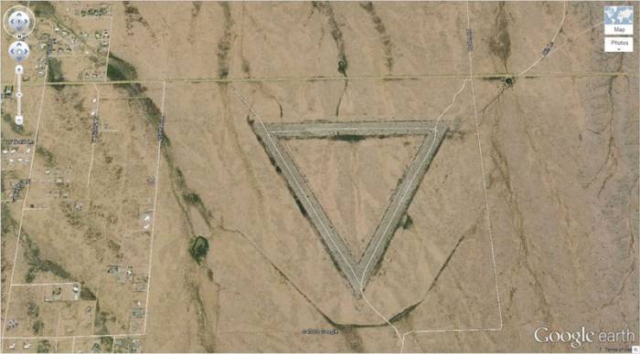
#2
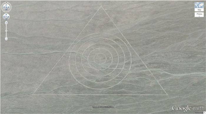
Giant Triangle
33.747252, -112.633853
Wittmann, Arizona, USA
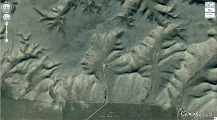
#3
The Badlands Guardian
50° 0'38.20″N 110° 6'48.32″W
Walsh, Alberta, Canada
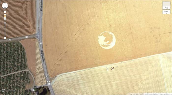
#4
Firefox Logo
45° 7'25.87″N 123° 6'48.97″W
Dayton, Oregon, USA
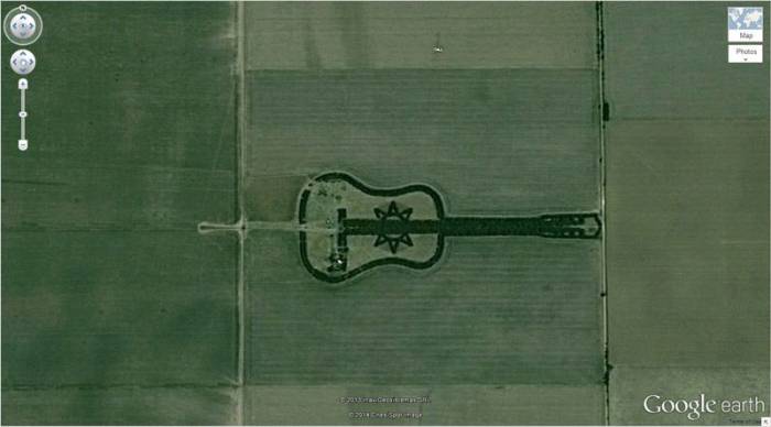
#5
Guitar-Shaped Forest
-33.867886, -63.987
Córdoba, Argentina
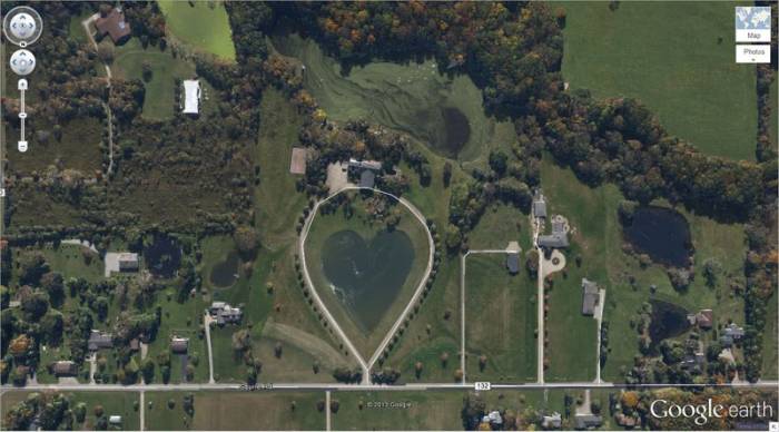
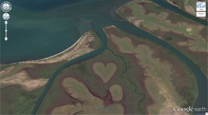
#6
Heart-Shaped Lake
41.303921, -81.901693
Columbia Station, Ohio, USA
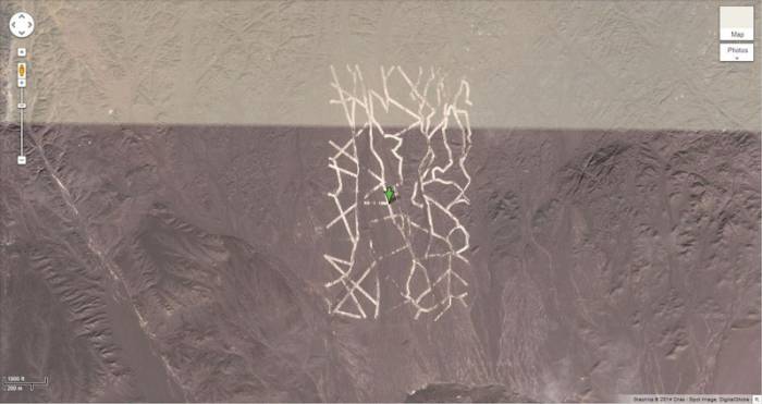
#7
Mysterious Desert Pattern
40.452107, 93.742118
China
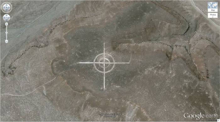
#8
Giant Target
37.563936, -116.85123
Nevada, USA
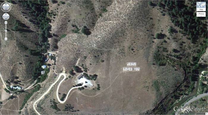
#9
Jesus Loves You
43.645074, -115.993081
Boise National Forest, Boise, Idaho, USA
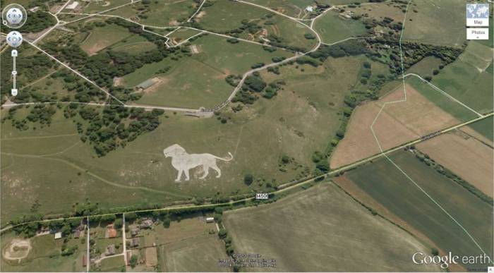
#10
Lion King
51.848637, -0.55462
Dunstable LU6 2LD, UK
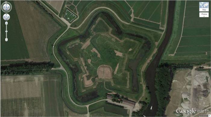
#11
Star Fort
Schansdijk 5, 4655 De Heen, The Netherlands
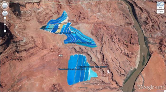
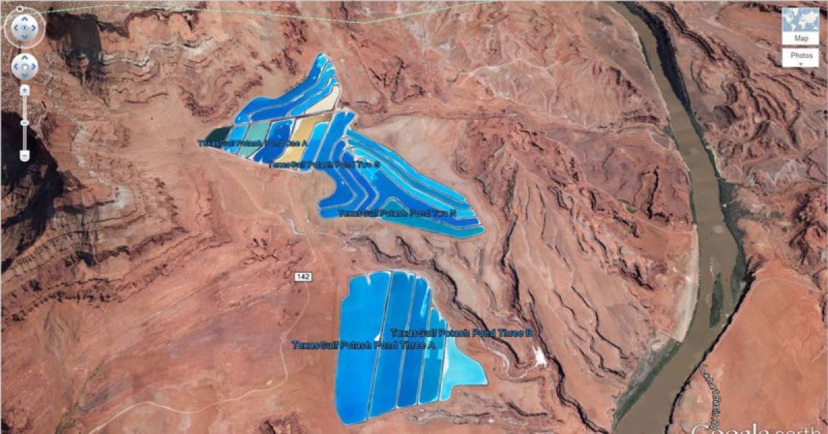
#12
Potash Ponds
38°29'0.16″N 109°40'52.80″W
Moab, Utah, USA
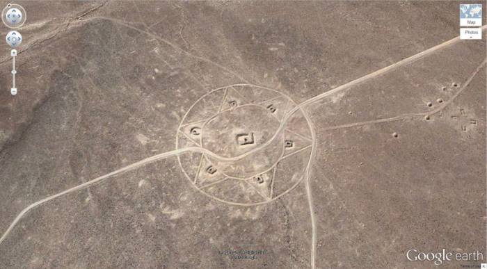
#13
Mysterious Pattern
37.629562, -116.849556
Nevada, USA
#14
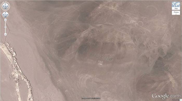
Coca Cola Logo
-18.529211, -70.249941
Arica, Arica y Parinacota, Chile
#15
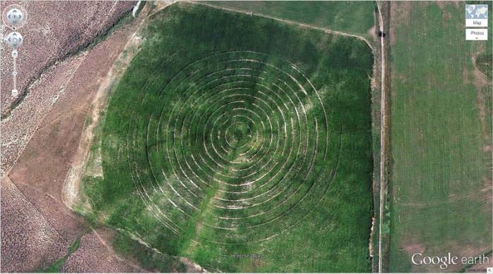
Concentric Cirlces
39.623119, -107.635353
New Castle, Colorado, USA
#16
Strange Symbol
37.401573, -116.867808
Nevada, USA
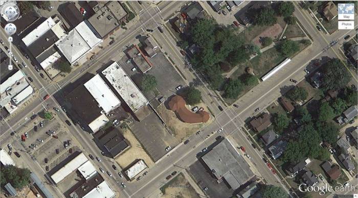
#17
A Most Phallic Buliding
41.84201, -89.485937
Dixon, Illinois, USA
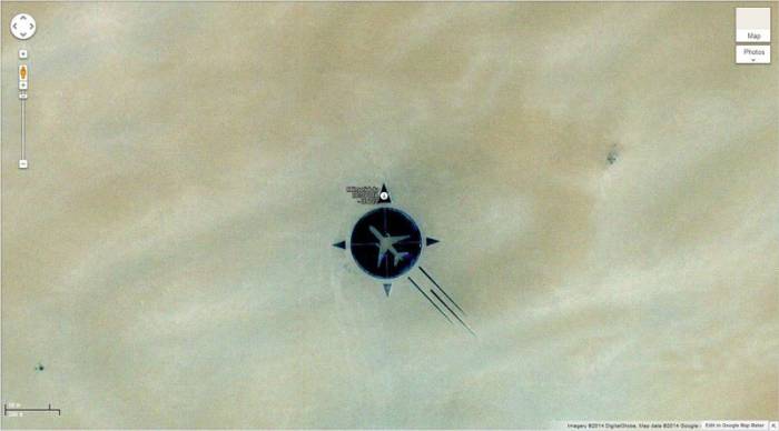
#18
UTA Flight 772 Desert Memorial
16.864841, 11.953808
Sahara Desert, southern Ténéré of Niger
#19
Heart-Shaped Land Formation
20°56'15.47″S, 164°39'30.56″E
New Caledonia
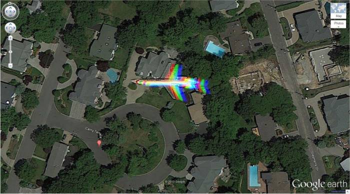
#20
Rainbow Plane
Cathy Terrace Englewood Cliffs, New Jersey , USA ‎
#21
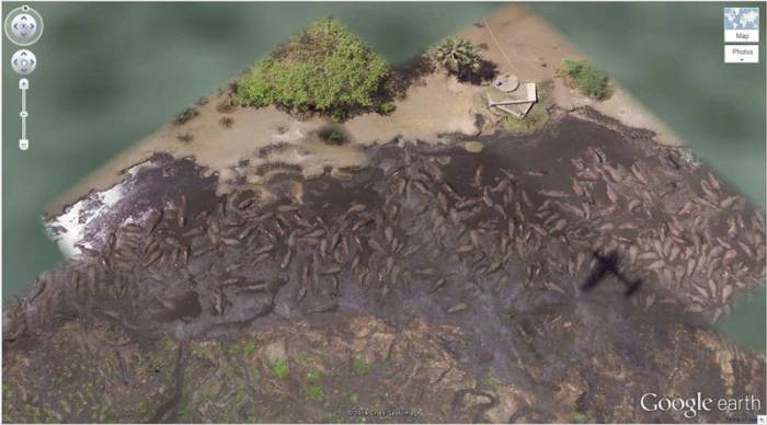
Hippo Pool
6°53'53.00″ S 31°11'15.40″ E
Katavi National Park, Tanzania
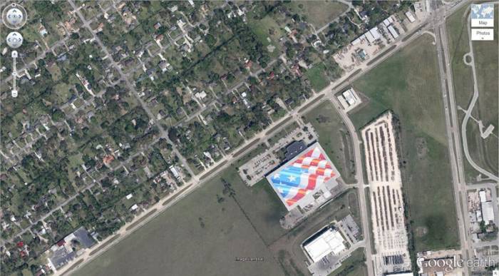
#22
Giant US Flag
7300 Airport Blvd, Houston, TX 77061, USA
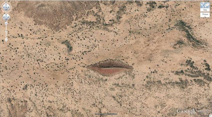
#23
Big Red Lips in the Desert
12°22'13.32″N, 23°19'20.18″E
Sudan
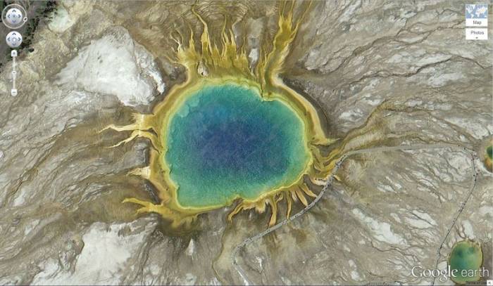
#24
Grand Prismatic Spring
44.525049, -110.83819
Yellowstone National Park, Wyoming, USA
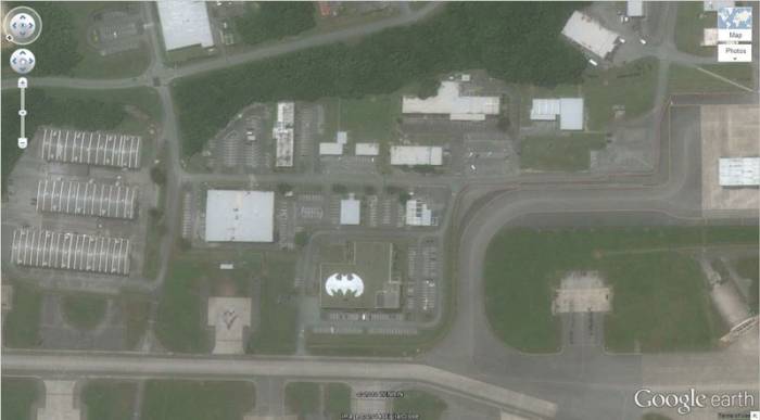
#25
Batman Symbol
26.357896, 127.783809
Okinawa, Japan