
Archaeologists have confirmed the location of a long-lost city established by Alexander the Great — a once-important trading center that had remained hidden for centuries beneath the landscape.
advertisement
The ancient settlement known as Alexandria on the Tigris lies in southern Iraq, close to the Persian Gulf.
The city was founded during the fourth century B.C. and served as a major port linking trade routes that connected India with Mesopotamia and the wider Mediterranean world.
Over time the city faded from history. By the third century A.D., the Tigris River had shifted its course, which led to the gradual decline of the once-busy trade hub.
After that point, Alexandria on the Tigris slowly disappeared from view and eventually became one of the many cities lost to time.
Modern technology reveals the city’s layout
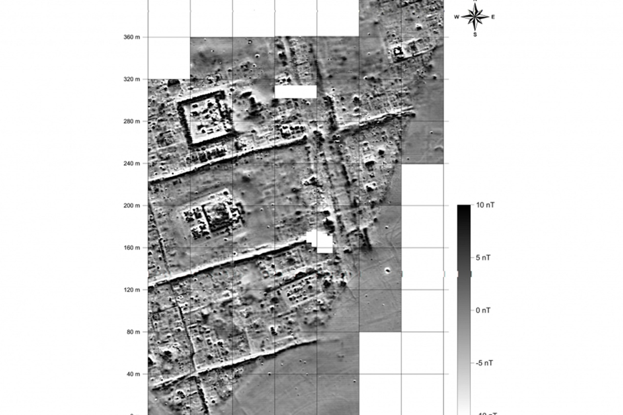
In recent years, archaeologists have been able to map large sections of the ancient city using modern technology.
Drone photography combined with high-resolution geophysical scanning allowed researchers to identify fortification walls, street grids, and large city blocks buried beneath the surface.
Although archaeologists have been working at the location since the 2010s, their research was complicated by instability in Iraq during a period when ISIS controlled parts of the region.
Only recently have scientists been able to piece together the full scale and structure of the ancient metropolis.
The University of Konstanz in Germany explained in a January 28 press release that researchers working at the site were "only allowed to conduct surface surveys under the close supervision of either soldiers or police officers."
Over the past few years, researchers have mapped the city’s fortification walls, street grids and city blocks.
Jove – stock.adobe.com
advertisement
Structures from the ancient port city uncovered
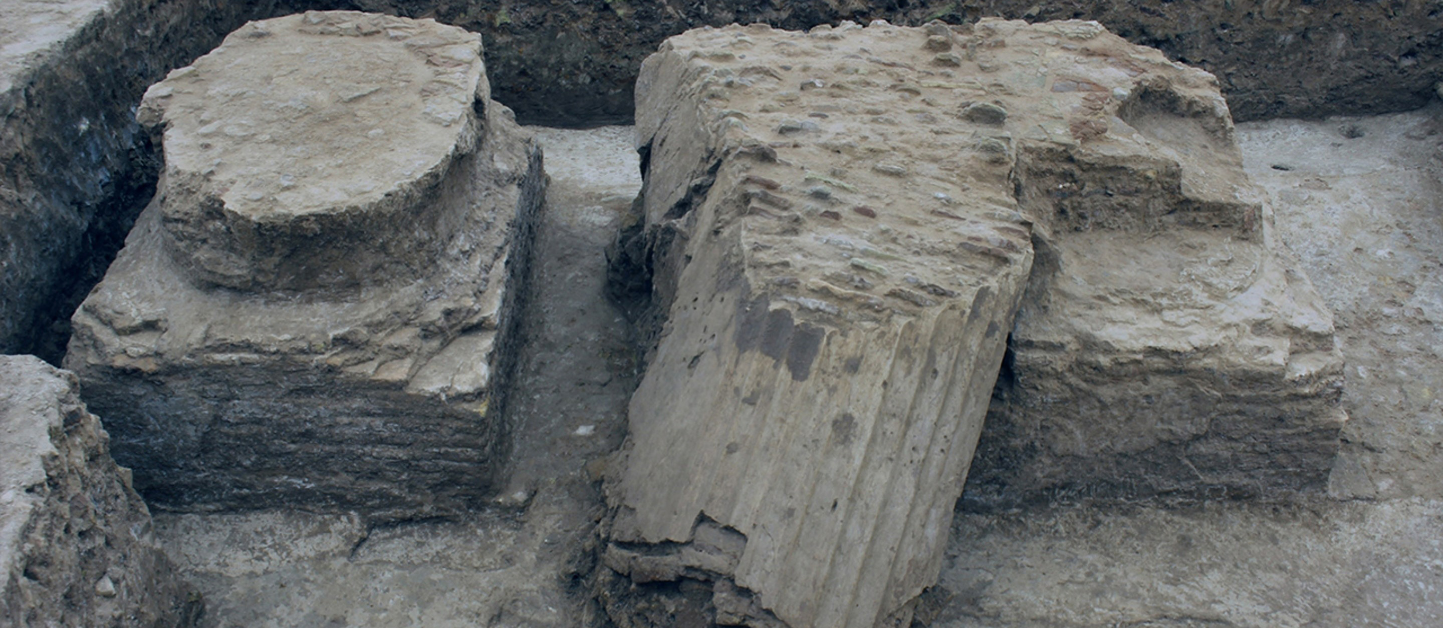
During their work, archaeologists identified several important structures within the buried city.
These included temple complexes, industrial workshops that contained kilns and furnaces, and the remains of the city’s harbor facilities and canal network.
The harbor system once played a key role in linking maritime trade routes with inland river transport.
According to Stefan R. Hauser, an archaeology professor at the University of Konstanz, the city had been "repeatedly flooded," but remained remarkably preserved beneath the soil.
Hauser told Fox News Digital that Alexandria on the Tigris was strategically positioned at a major meeting point between river transport and sea trade, much like the better-known city of Alexandria in Egypt.
A strategic location chosen for trade
The settlement was established during a time when southern Mesopotamia needed a new harbor to handle expanding trade routes with India.
The location allowed merchants to move goods between the Persian Gulf and the interior river networks that connected the region to other major cities.
This made the city an important hub in the trade systems that linked the ancient world.
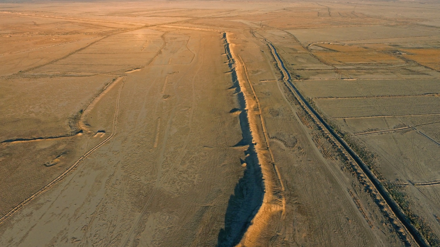
The ancient city, known as Alexandria on the Tigris, is located in southern Iraq, near the Persian Gulf.
Charax Spasinou Project/Stuart Campbell
advertisement
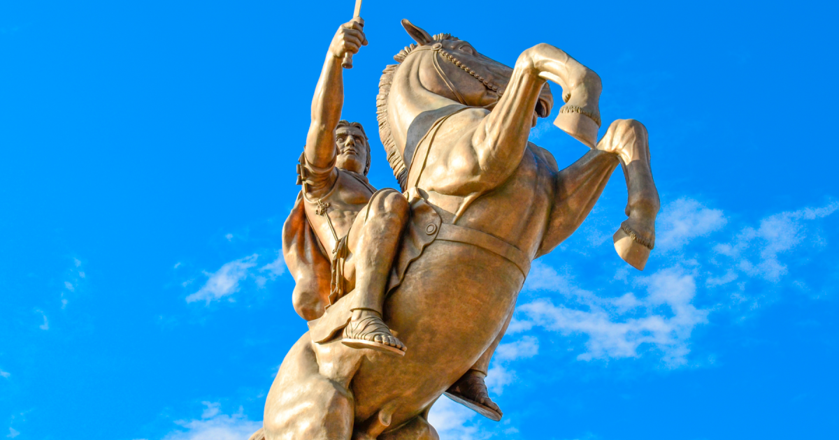
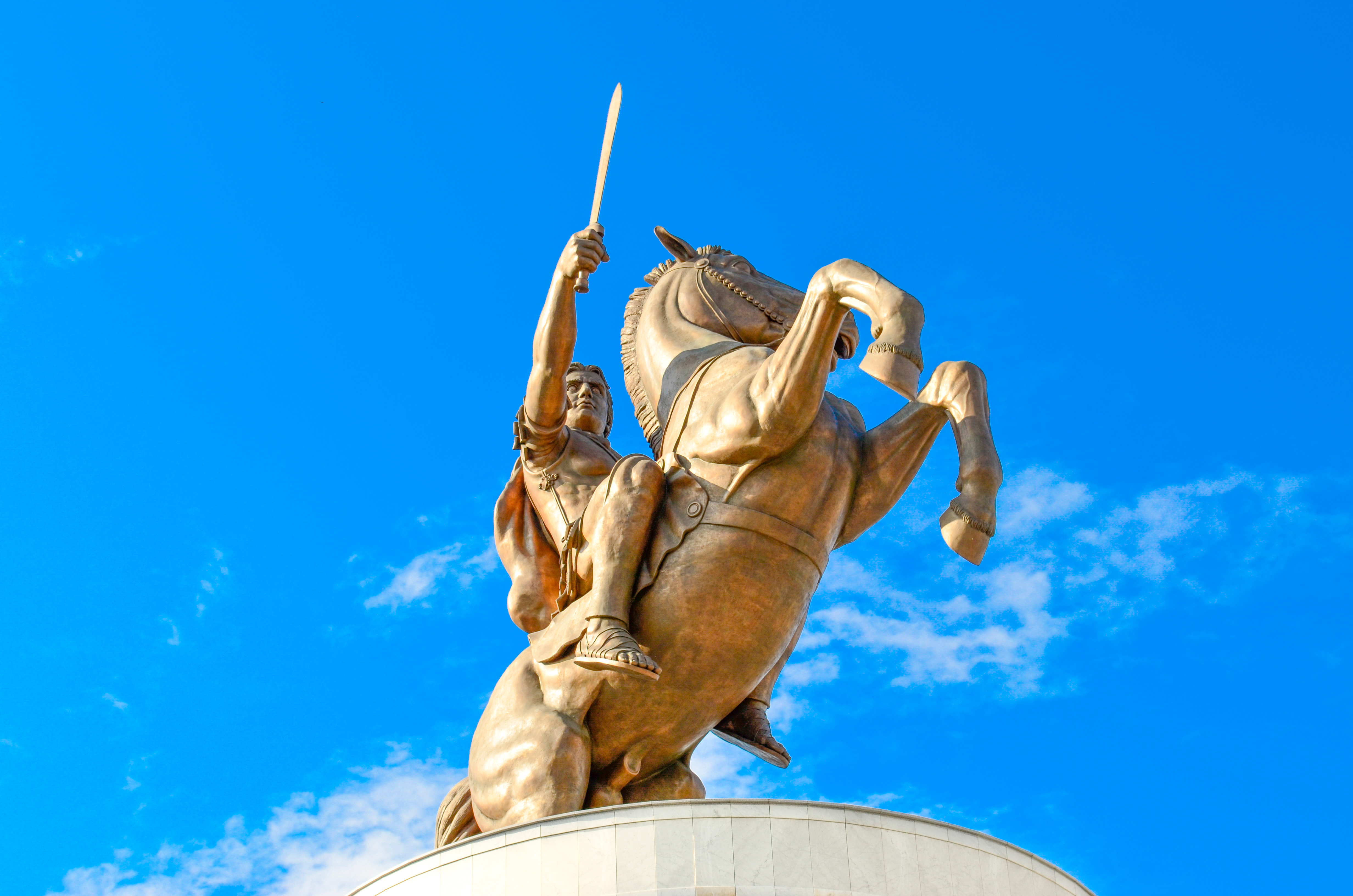
Alexander the Great’s role in founding the city
Hauser explained that historical sources suggest Alexander the Great personally selected the location in 324 B.C.
The information comes from accounts by the Roman writer Pliny the Elder, who drew on even older historical records.
Alexander, the Macedonian ruler who conquered the Persian Empire, was attracted to the location because of its strategic position along the river.
The archaeologist said he was surprised by the overall scale of the city, which covered about 2.5 square miles and which he described as "enormous for an ancient city."
The city had been “repeatedly flooded,” but it was miraculously well-preserved, said Stefan R. Hauser.
Art Images via Getty Images
advertisement
"The size of the city blocks is extraordinary," he said. "It surpasses even those of the major capitals of the time, like Seleucia on the Tigris or Alexandria on the Nile."
Hauser added, "The quality of the geophysical evidence is absolutely stunning… The preservation of buildings is surprisingly good, and we started identifying the walls immediately beneath the surface, which also accounts for the good results in geophysical exploration."
The research project itself began in 2016 and was first led by British archaeologists Jane Moon, Robert Killick, and Stuart Campbell.
Hauser credited these scholars with launching the modern investigation that eventually revealed the layout of the long-lost city.
Archaeologists have worked at the site since the 2010s, a time when ISIS exerted control over Iraq.
Charax Spasinou Project/Robert Killick
advertisement
Challenges faced during excavation
Excavating the ancient site has presented several challenges for the research team.
During the summer months, temperatures in the region often rise above 120 degrees Fahrenheit, making fieldwork extremely demanding.
Researchers must also contend with air pollution that affects parts of the surrounding region.
Despite these obstacles, the team hopes to continue exploring the city’s neighborhoods and the industrial areas where workshops and kilns once operated.
Future excavation plans depend largely on whether additional funding becomes available.
Hauser also emphasized that the location could offer valuable insights into the Parthian Empire, which ruled the city centuries after Alexander’s conquest.
According to him, the Parthian Empire remains one of the least understood powers of the ancient world.
The team of researchers plans to investigate the city’s quarter and its workshops and kilns in the future, pending funding.
Jorg Fassbinder
advertisement
Why the discovery is so significant
"There is not a single useful summary [of] its history, structure and culture," said Hauser.
The archaeological site is "particularly well suited for this kind of research, because there has been no later building activity since antiquity," he explained.
"We have the nearly unique chance to reconstruct an entire city plan [through] geophysical research, and currently hope to complete geophysics this year."
If researchers succeed in mapping the entire area, they may gain one of the clearest views ever obtained of how a major Hellenistic city was organized.
For historians, that opportunity could reshape how scholars understand the economic and cultural networks that connected the ancient Mediterranean world with Asia.