
Egypt's Khufu pyramid has a strange structure located 'five miles due south' which is sparking theories online
advertisement
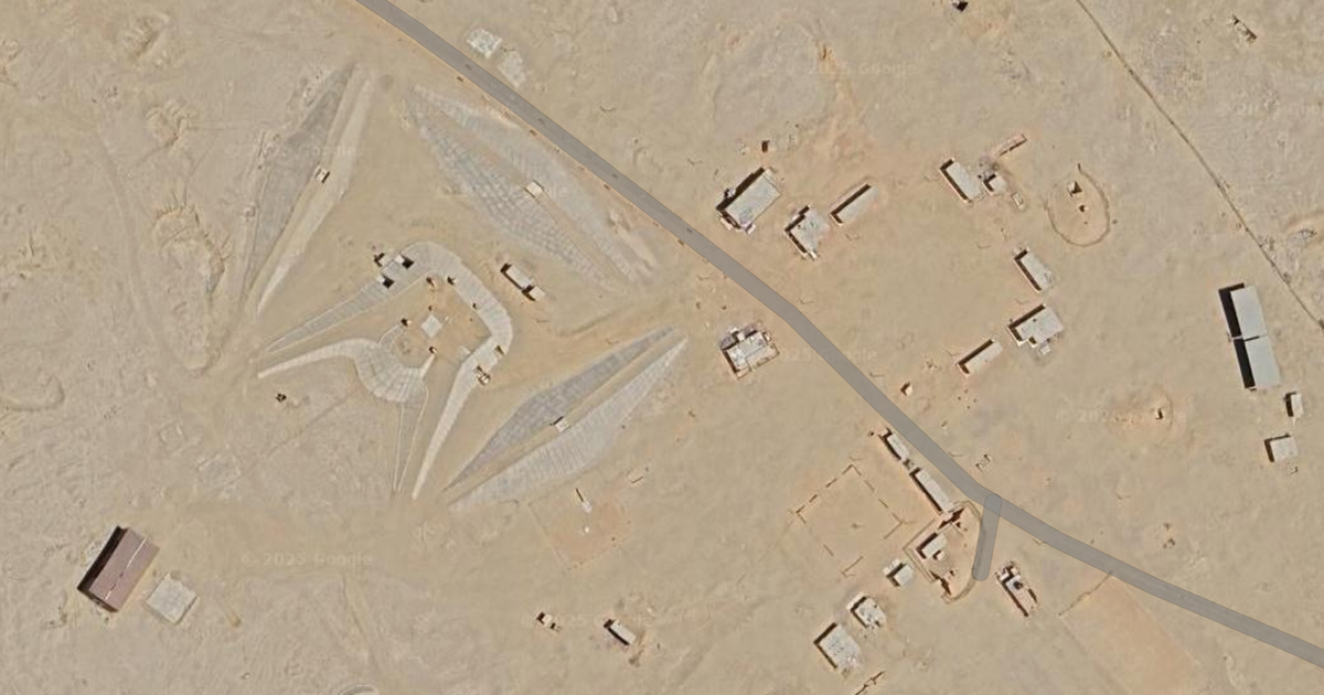
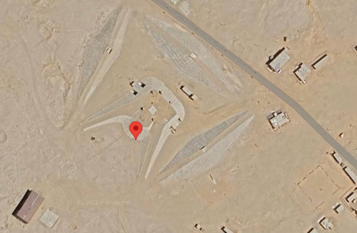
A strange structure spotted just a few miles from Egypt’s famous Khufu pyramid has left people on the internet puzzled and full of questions.
One user browsing Google Maps ended up sharing an unusual find to Reddit, pointing out a unique shape or facility not far from the Giza pyramids.
The coordinates for the site are 29°54'23"N 31°08'02"E, located exactly five miles due south of the Khufu pyramid. Now, people are trying to figure out what exactly it could be.
The Redditor shared the image in the r/AlternativeHistory forum, posting a screenshot from Google Maps of the puzzling location. They added their thoughts, writing: "What in the Stargate is this? [...] I can't find it labeled on any maps. Is anybody here familiar with this place?"
It didn’t take long for fellow users to start offering up all kinds of wild and not-so-wild guesses.
One commenter chimed in: "If it was nevada i'd say rich guy's art project."
advertisement
"Probably an ammunition bunker for the military," another person said, while someone else threw in a different idea: "Anti aircraft missile or radar installation."
A fourth user noted: "I've now found a website showing the place with a similar assessment."
Interestingly, this site isn’t exactly new to the internet. Back in 2005, someone posted the same location to Virtual Globetrotting and asked whether the structure might be a SA-2 missile battery.
What do you think it could be?
Google Maps
In that older post, someone replied: "This one appears to be an SA-2 battery, split to better cover a particular section of the compass. The northern three revetments are empty but the southern three appear to have SA-2 launchers in them, but not missiles."
"The mounds are used to get a bit more height for the radar antenna. Even getting them up 20 or 30 feet above the flat desert makes a huge difference in range."
However, not everyone agrees. One person suggested it’s more likely to be a radar installation than anything else.
advertisement
This isn’t the first oddity to get attention on Google Maps lately. Earlier this year, people noticed what looked like a disc-shaped object that stirred up plenty of eerie speculation.
The object was spotted at coordinates 34°24'21.6"N 107°05'44.5"W, located around 34 miles from Sevilleta National Wildlife Refuge near La Joya, New Mexico.
From above, it appeared to be a large white disc with what looked like metallic components. Part of it was obscured by trees and shrubs.
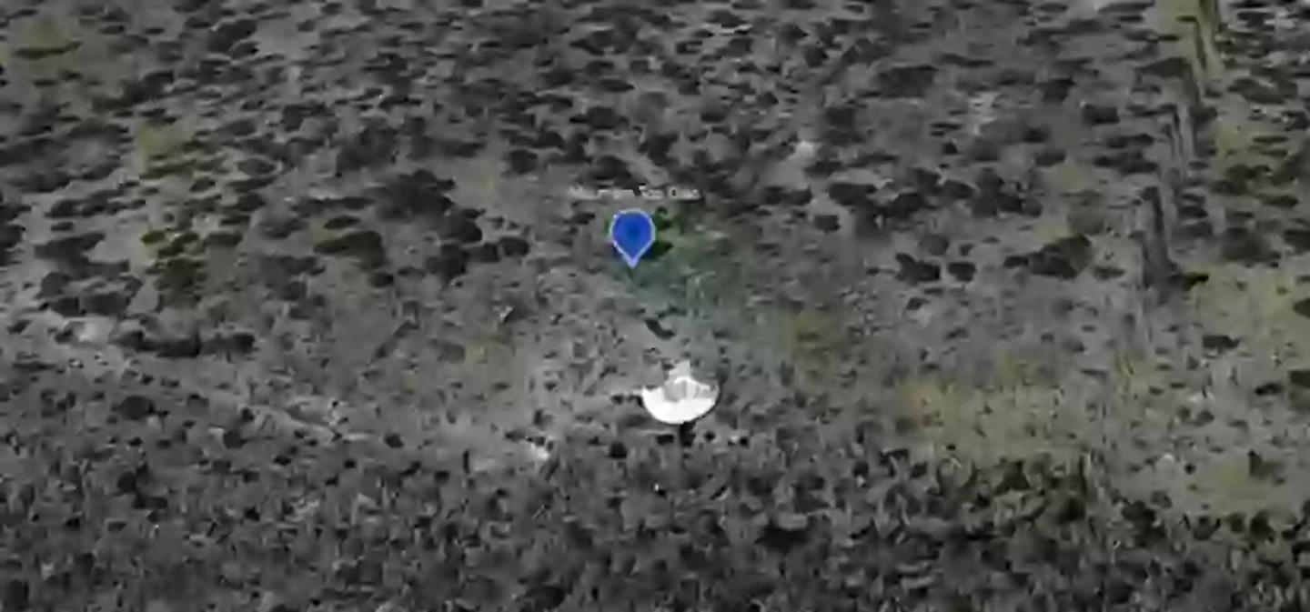
Is it a crashed UFO?
Google Maps/YouTube/MrMBB333
advertisement
The online crowd was pretty split over the find. Reddit users suggested it might be a crashed UFO embedded in the hillside.
Meanwhile, others on Twitter said it looked more like a satellite calibration target used for testing and alignment.
So the mystery remains. What do you think it could be?