
To commemorate the monumental discoveries made over the years, NASA is sharing stories and videos about how much views from up above have taught us about life on our home planet and the search for life elsewhere.
NASA Shows How Earth Has Changed Over The Past 20 Years And It's Breathtaking
By
Sughra Hafeez in
Amazing
On 18th November 2017
advertisement
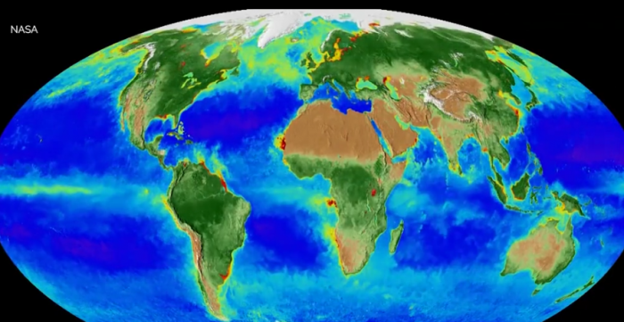
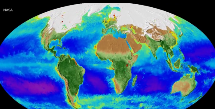
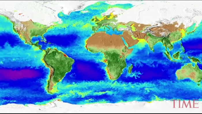
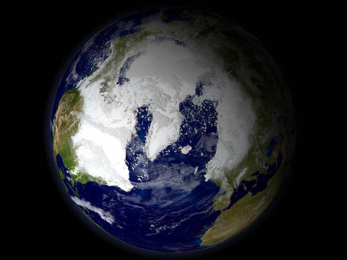
A new time-lapse animation captures 20 years worth of the planet’s changing land and ocean life as seen from the Sea-viewing Wide Field-of-view Sensor (SeaWiFS), which launched in 1997.
The timelapse follows two decades of constant image collection from a NASA satellite capturing both seasonal patterns that occur every year and longer term changes.
advertisement
The video reveals how snow coverage changed from year to year, advancing and receding from the polls according to the seasons. It also shows changes in vegetation and phytoplankton concentration (in purple) on the ocean’s surface.
“That’s the Earth,” said Gene Carl Feldman, a NASA oceanographer, in a press release. “That is it breathing every single day, changing with the seasons, responding to the Sun, to the changing winds, ocean currents, and temperatures.”
advertisement
Over the past 20 years, NASA scientists have monitored the health of crops, forest's and fisheries around the globe and learned more about the long-term changes across continents and ocean basins, the agency wrote in the news release.
advertisement
This uninterrupted collection of data from multiple satellites helps scientists to tackle important questions on how ecosystems react to human activity.
“As the satellite archive expands, you see more and more dynamics emerging,” said Jeffrey Masek, chief of the Biospheric Sciences Laboratory at NASA Goddard. “We’re now able to look at long-term trends.”
advertisement
Satellite observations and measurements have helped determine agricultural production, used in famine early warning detection, and as carbon dioxide rises and warms the planet’s climate, NASA’s knowledge of planet life learned from its 20-year observations, will play a major role in monitoring carbon in the Earth’s system.
advertisement
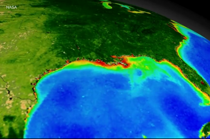
The satellites have also been able to monitor the ocean’s subtly changing colors, helping satellites track changes in phytoplankton populations.
advertisement
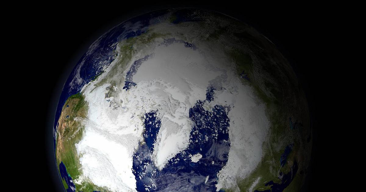
The satellite images show the Arctic getting greener, as shrubs expand their range and thrive in warmer temperatures. Rising sea-surface temperatures have staggered the growth of phytoplankton, an organism that helps in the removal of carbon dioxide.
advertisement
Signs of environmental change are especially visible in Arctic regions and in Alaska, where burned areas due to fires, deforestation and other changes, led the region’s underlying permafrost to burn off.
“It’s like taking the insulating layer off a cooler,” Chris Potter, a research scientist at NASA’s Ames Research Center in California, said. “The ice melts underneath and it becomes a slushy mess.”
advertisement
Watch the video here: