
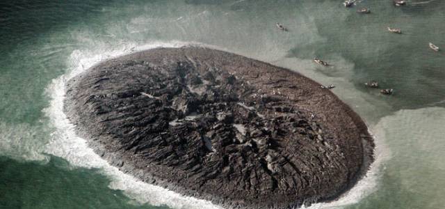

On the 24th of September, 2013, a 7.7 magnitude earthquake in the Pakistani province of Balochistan gave rise to a mud island of the Makran region of the province's coastline. More than 500 people were killed in the quake and thousands made homeless. Now locally known as the "Zalzala Jazeera" or Earthquake Island, scientists say that the island is a transient feature and may last up to a year.
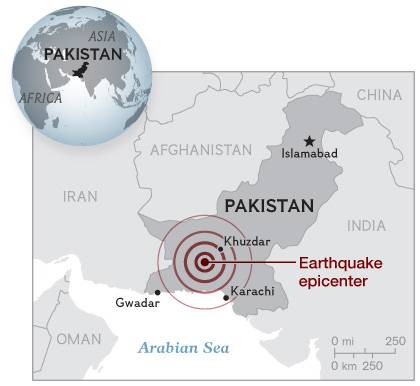
The island is located some 380 km south of the epicenter, near Khuzdar, the nearest city next to the epicenter.
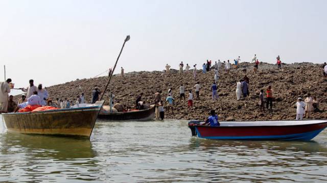
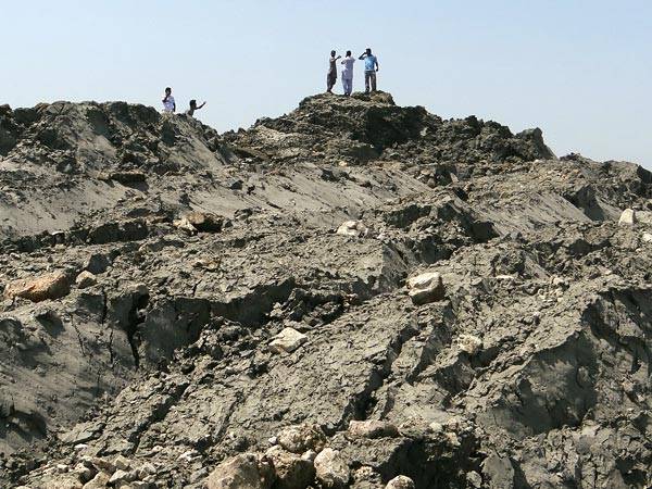
According to scientists, the island is no more than a pile of mud, sand and rock that was caused by highly pressurized gas that was released during the earthquake. The island is about a mile from the shore and the depth of water around the island hovering around 15 to 20 meters. It is about 18 to 21 meters high, up to 91 meters wide, and up to 37 meters long.
How are such islands formed?
According to Bill Barnhart a US geologist at the US Geological Survey while speaking to the NASA Earth Observatory said:
“The island is really just a big pile of mud from the seafloor that got pushed up. This area of the world seems to see so many of these features because the geology is correct for their formation. You need a shallow, buried layer of pressurized gas—methane, carbon dioxide, or something else—and fluids. When that layer becomes disturbed by seismic waves (like an earthquake), the gases and fluids become buoyant and rush to the surface, bringing the rock and mud with them."