
According to the research, the land under India is splitting.
Scientists Discover One Of The Biggest Countries In The World Is 'Splitting In Two'
By
Editorial Staff in
News
On 21st June 2024
advertisement
Scientists have found that the tectonic plate beneath India might be splitting into two parts.
This is an exciting and interesting finding because tectonic plates are massive pieces of the Earth's crust that move and shift over time.
India is the seventh largest country in the world.
It is smaller than some other big countries like Australia, Brazil, and the US.
advertisement
Even though it's not the biggest, it’s still pretty large!
It covers about 3.287 million km².
advertisement
That's a huge amount of land!
If it were to split vertically, it would form two countries each around the size of Mongolia.
advertisement
However, scientists think India is splitting horizontally instead of vertically.
This idea was first shared at the American Geophysical Union conference in December 2023.
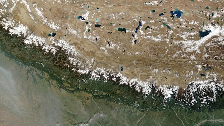
Researchers looked at the plates underneath the Himalaya.
Getty Images / Nazim Ali Khan / NurPhoto
The study, called "Slab tearing and delamination of the Indian lithospheric mantle during flat-slab subduction, southeast Tibet," looks at how the Himalayas were formed.
advertisement
The Himalayas are a huge mountain range stretching across five countries: India, Pakistan, Nepal, China, and Bhutan.
According to the Geological Society, "the Himalayan mountain range and Tibetan plateau have formed as a result of the collision between the Indian Plate and Eurasian Plate which began 50 million years ago and continues today."
advertisement
The study, led by Lin Liu, Danian Shi, Simon L. Klemperer, and others, started by looking at the levels of helium in the Tibetan springs.
Helium is a gas that can tell scientists a lot about what's happening deep underground.
advertisement
They came up with a new idea about the plates under the mountain range.
They found that helium levels were higher in southern Tibet compared to northern Tibet.
The study focused on the Indian and Eurasian tectonic plates.
Getty Images / DEA / D'ARCO EDITORI / De Agostini
This was a big clue for them.
advertisement
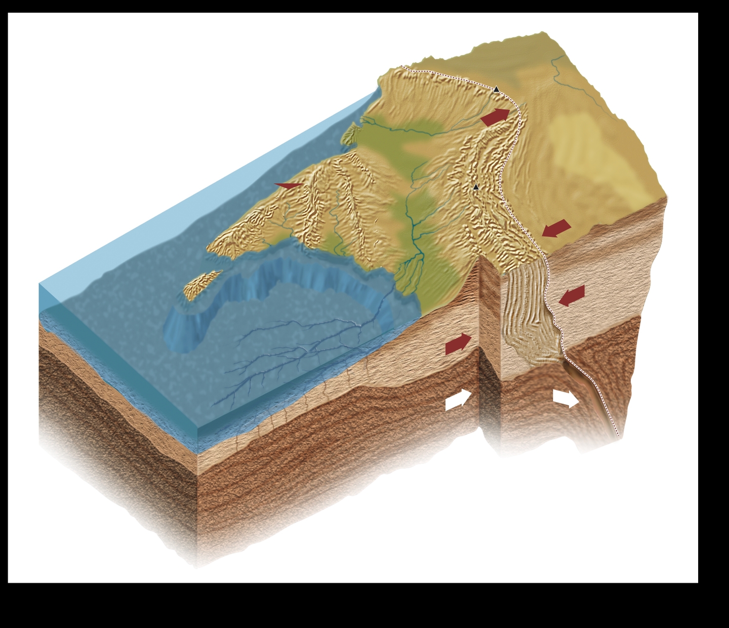
This suggests that the Indian tectonic plate is splitting into two parts beneath the Tibetan plateau.
The researchers then used "3D S-wave receiver-functions" to study the Indian Plate.
advertisement
This technique uses data from distant earthquakes to create images of the Earth's structure and its internal boundaries.
The study, published in ESS Open Archive, explains: "Our 3D S-wave receiver-functions newly reveal orogon-perpendicular tearing or warping of the Indian Plate."
advertisement
One of the images showed that the top and lower slabs of the Indian Plate might be separating.
This suggests that the Indian Plate is "underplating" or "subducting" beneath a "mantle wedge."
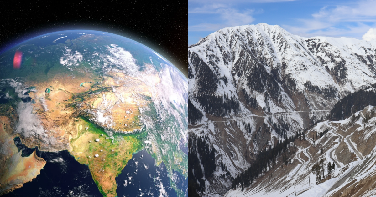
Himalayas as seen from space.
Nasa
The study concludes: "Our SRFs objectively map depths to distinct Indian and Tibetan lithosphere-asthenosphere boundaries across a substantial region of south-eastern Tibet.
"The inferred boundary between the two lithospheres is corroborated by more subjective mapping of changing SWS parameters, and by independent interpretations of the mantle suture from mantle degassing patterns and the northern limit of sub-Moho earthquakes."
In simple terms, this means the Indian Plate would split into two parts by peeling away rather than breaking apart into separate pieces.